Trail Walking La Chaudière - 26 chaudière courance gleizolle - Photo

26 chaudière courance gleizolle

© OpenStreetMap contributors
Length
Length
16.1 km
Max alt
Max alt
1020 m
Uphill gradient
Uphill gradient
665 m
Km-Effort
Km-Effort  
25 km
Min alt
Min alt
463 m
Downhill gradient
Downhill gradient
584 m
Boucle
Boucle
No
Creation date :
2021-02-28 08:21:01.54
Updated on :
2021-02-28 15:35:16.064

(0 Reviews)

Walking
Walking
4h26
Difficulty : Very difficult

Scan this QR Code to open this trail in the SityTrail application

FREE GPS app for hiking

Logo SityTrail SityTrail

IGN / Geographical institutes

Download SityTrail from the App Store Download SityTrail from Google Play

Logo SityTrail SityTrail World

The world is yours!

Download SityTrail from the App Store Download SityTrail from Google Play Download SityTrail on Huawei AppGallery

About

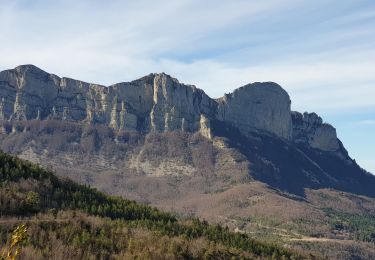
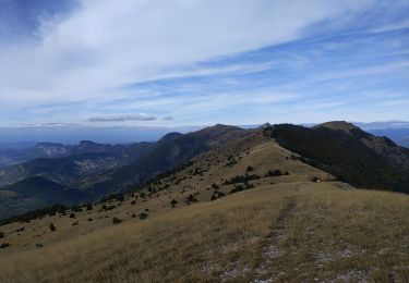
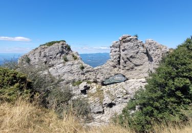
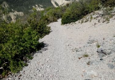
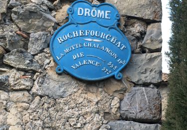
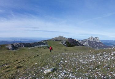
Trail Walking of 16.1 km to be discovered at Auvergne-Rhône-Alpes, Drôme, La Chaudière. This trail is proposed by himba26100.

Description

gêne jp 28 02 2021
corde 12m 2 sangles 4 dégaines
itinéraire difficile ds le verrou
bcp d eau

Elevation profile

Photos

Positioning

Country:
France
Region :
Auvergne-Rhône-Alpes
Department/Province :
Drôme
Municipality :
La Chaudière
Location:
Unknown
Start:(UTM)
675752 ; 4944502 (31T) N.

Trails nearby

Trail Walking Bourdeaux - Chemin des protestants- Bourdaux - Photo
Walking
crocau

Walking

Medium
(1)
Bourdeaux, Auvergne-Rhône-Alpes, Drôme, France
7.9 km | 11.2 km-effort
2h 48min
Yes
Trail Walking La Chaudière - Les 3 Becs - Photo
Walking
Noiraude

Walking

Medium
(1)
La Chaudière, Auvergne-Rhône-Alpes, Drôme, France
10.3 km | 21 km-effort
5h 37min
Yes
Trail Walking La Chaudière - La chaudiere - chapelle des Sadoux - Photo
Walking
bob2023

Walking

Very easy
(2)
La Chaudière, Auvergne-Rhône-Alpes, Drôme, France
11.1 km | 18.2 km-effort
3h 47min
Yes
Trail Walking La Chaudière - les trois becs - Photo
Walking
GUIDE
amiral13

Walking

Medium
La Chaudière, Auvergne-Rhône-Alpes, Drôme, France
11.7 km | 23 km-effort
6h 25min
Yes
Trail Walking Rochefourchat - Serre Délégué depuis Rochefourchat 15 10 23 - Photo
Walking
bymarc26

Walking

Medium
Rochefourchat, Auvergne-Rhône-Alpes, Drôme, France
14.3 km | 25 km-effort
4h 29min
Yes
Trail Walking La Chaudière - 070823 Boucle des 3 Becs - Photo
Walking
mzonzon05

Walking

Very difficult
La Chaudière, Auvergne-Rhône-Alpes, Drôme, France
11.4 km | 23 km-effort
4h 58min
Yes
Trail Walking Bézaudun-sur-Bîne - Fonderesse - Photo
Walking
AIGUIER

Walking

Difficult
Bézaudun-sur-Bîne, Auvergne-Rhône-Alpes, Drôme, France
13.8 km | 22 km-effort
27h 34min
Yes
Trail Walking Rochefourchat - Grand Delmas depuis Rochefourchat - Photo
Walking
ajd26

Walking

Medium
Rochefourchat, Auvergne-Rhône-Alpes, Drôme, France
16.6 km | 28 km-effort
5h 25min
Yes
Trail Walking Rochefourchat - Rochefourchat (ASPTT) - Photo
Walking
TOULAUDIN

Walking

Medium
Rochefourchat, Auvergne-Rhône-Alpes, Drôme, France
14 km | 25 km-effort
5h 42min
Yes


Close
My subscriptions